Nam Ngiep 1 Dam Hydropower info by Hobo Maps - Go to Hydropower Page --- Home
Nam Ngiep is pronounced like "Nam Nyiep".
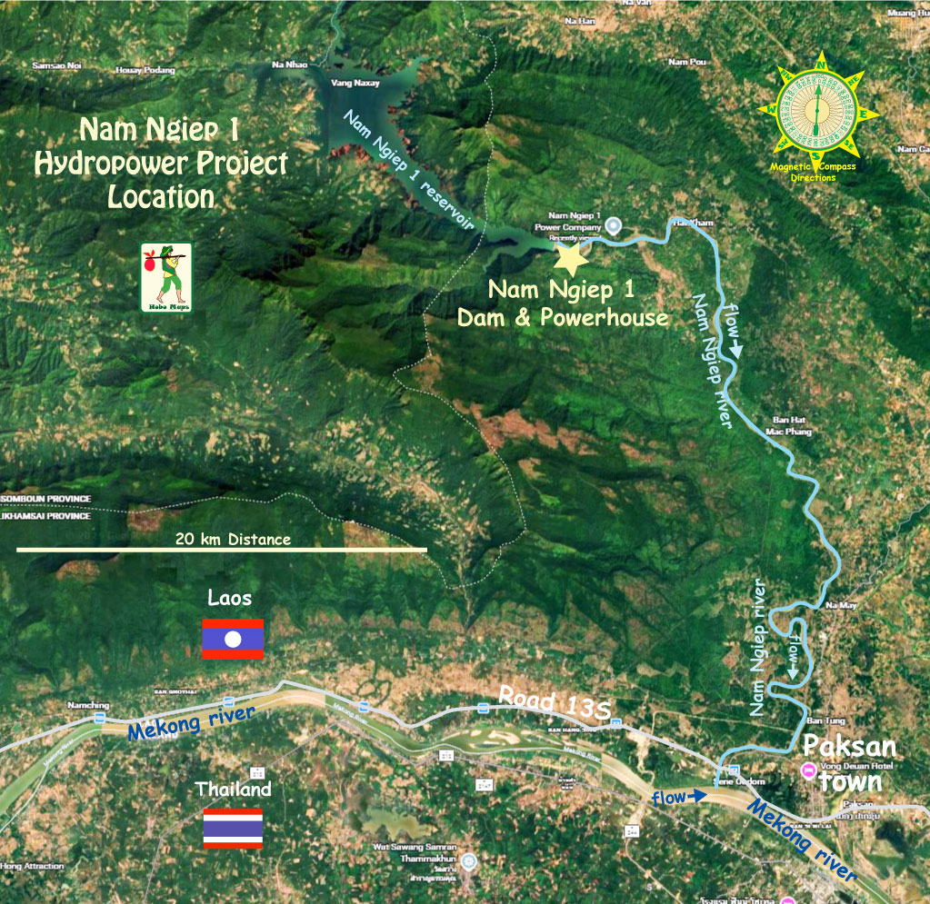
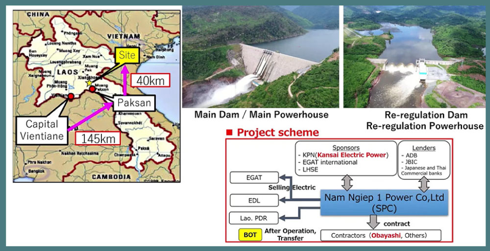
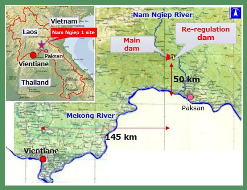
Nam Ngiep 1 Hydropower Project (NNP1) is located on the Nam Ngiep river which originates in Xieng Khouang Province near the Plain of Jars and flows 1,300 meters lower in elevation for 160 km before joining the Mekong River near Paksan. The main dam is about 50 km northwest of Paksan town as the most downstream dam on the Nam Ngiep river .
The main dam, a regulation dam and two powerhouses are located in Bolikhan District, Bolikhamxay Province while a major part of the reservoir is in Hom District, Vientiane Province of Lao PDR.
This Nam Ngiep 1 hydropower project is not related to other Nam Ngiep projects in the same area such as Nam Ngiep 2 or the Nam Ngiep 2A, 2B & 2C projects developed by Nonghai Group.
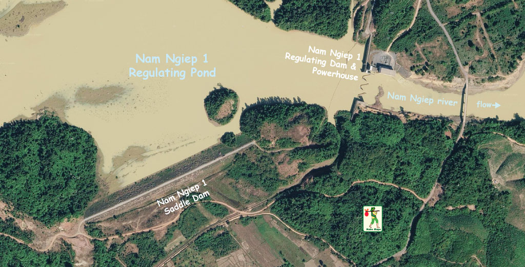
Location of the Nam Ngiep 1 Hydropower project shown in satellite image below near coordinates 18°38'49.2"N 103°32'31.2"E (18.647, 103.542):
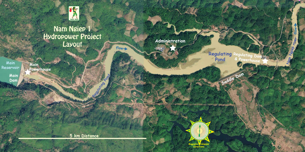
Project Layout map below:
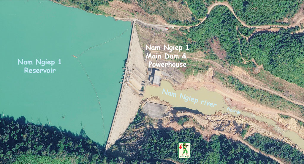
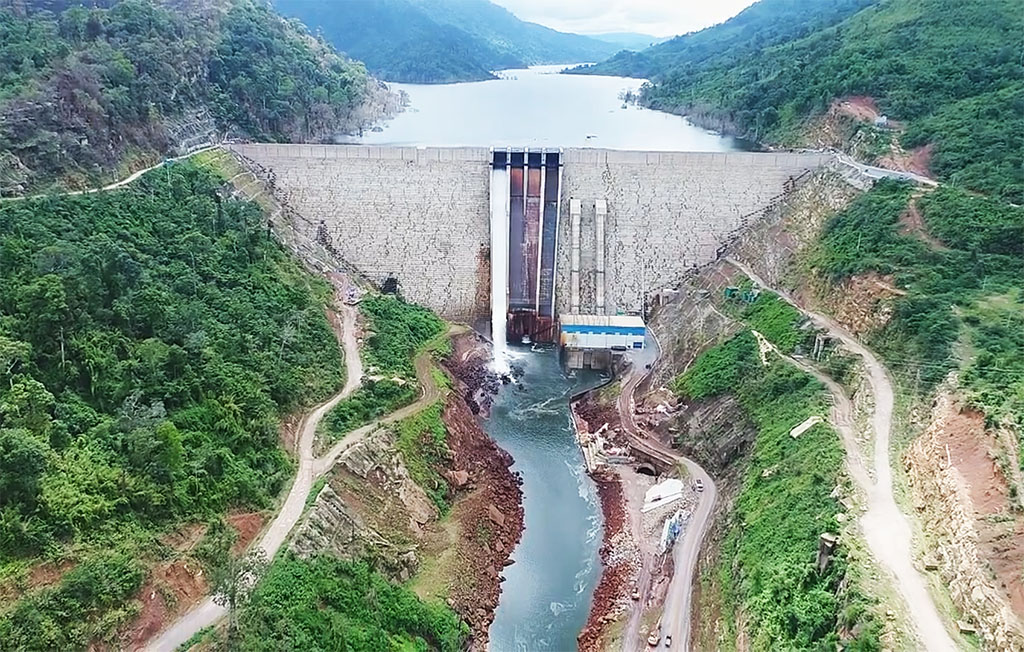
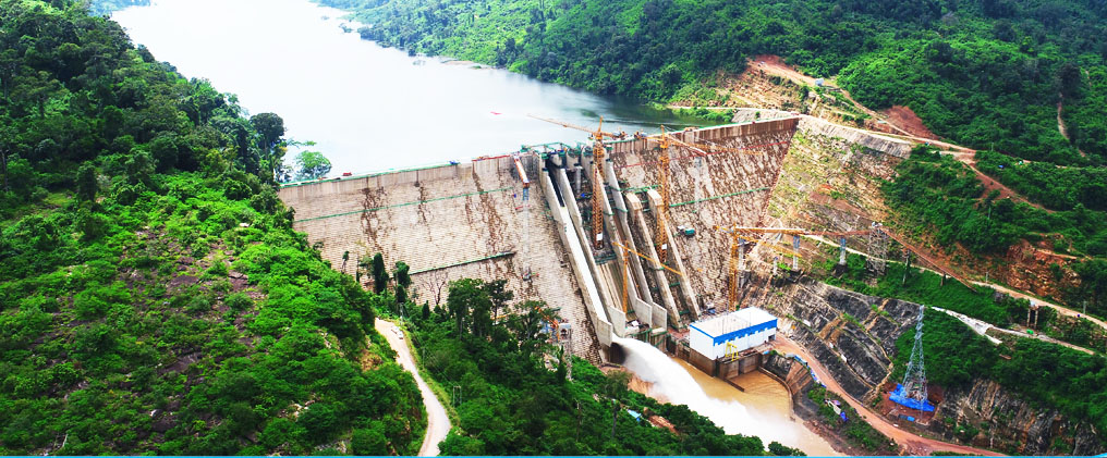
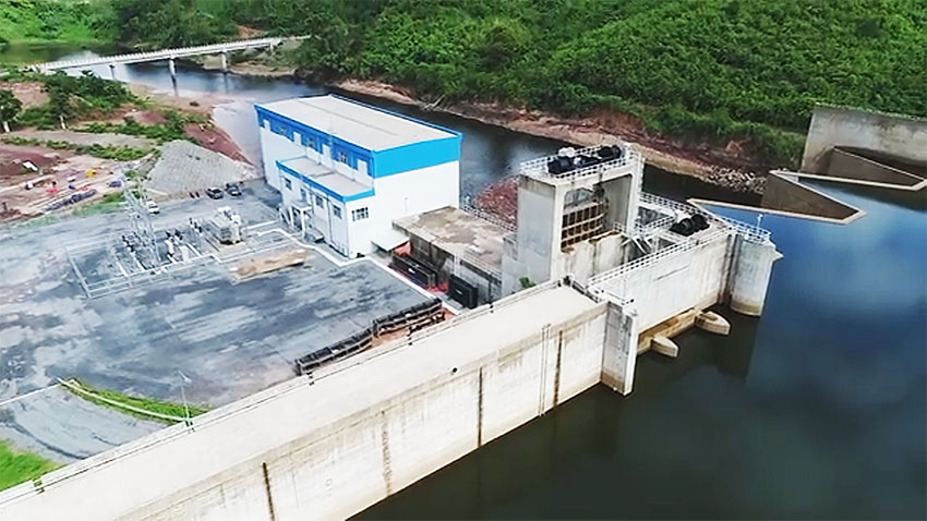
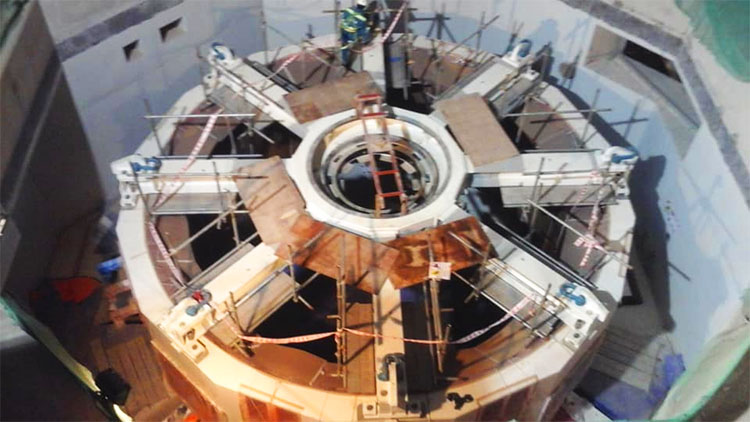
Main Dam & Powerhouse image below:
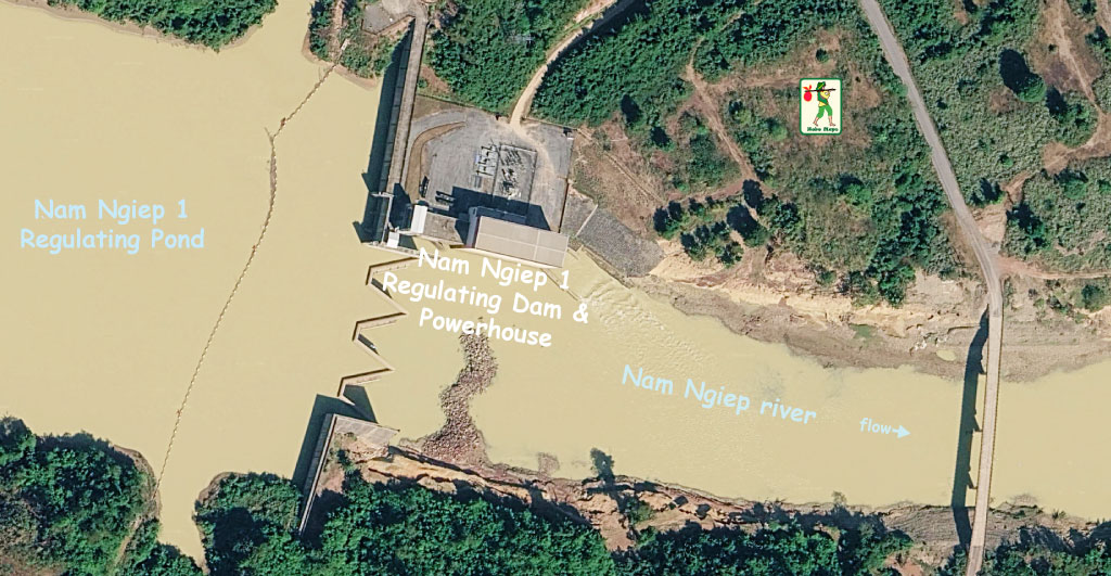
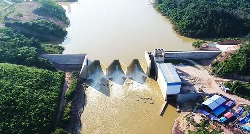
Regulating Dam & Powerhouse images below:
Nam Ngiep 1 Main Dam and Main Powerhouse seen together in images below:
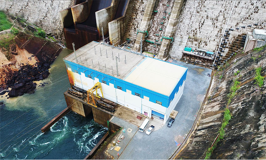
Powerhouse in image above is blue & white building at main dam site and very similar blue & white building is at regulating dam site in image below, very easy to confuse these images.

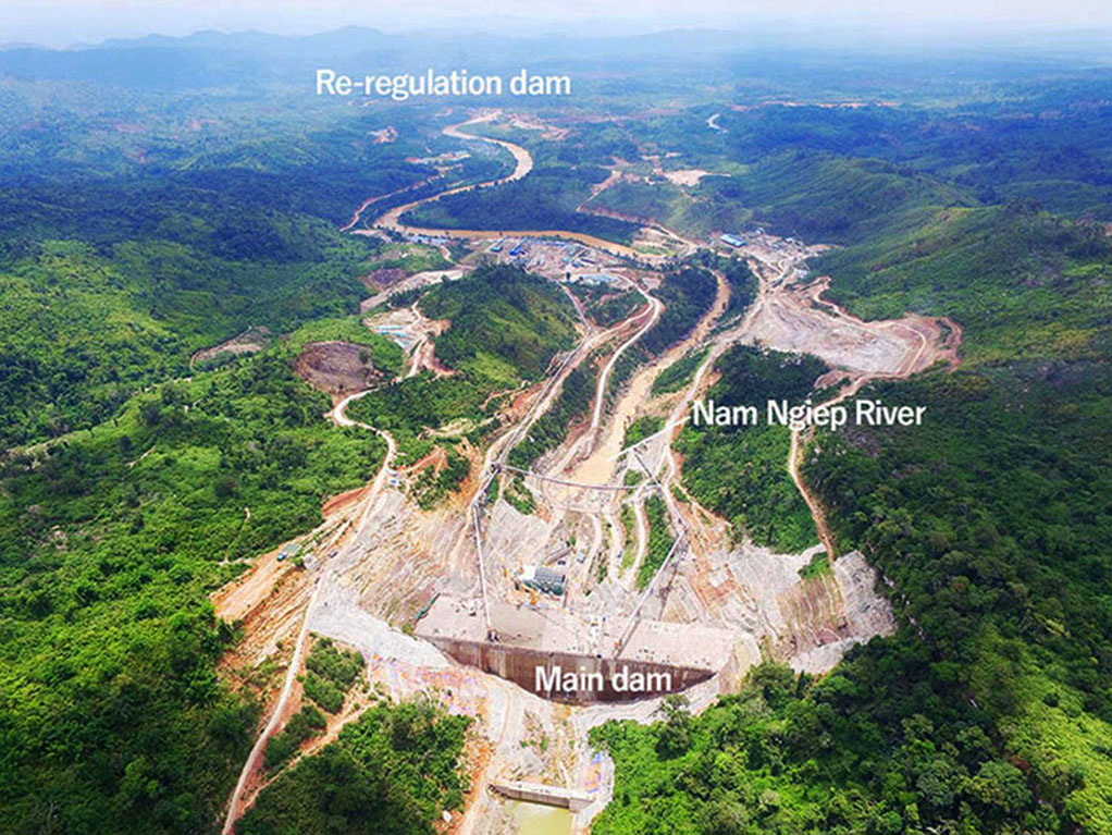
Nam Ngiep 1 main dam creates a 70-km-long narrow reservoir that extends up the Ngiep valley as far as Thathom District. The dam is in a steep natural canyon in the lower part of the Nam Ngiep catchment area which allows for a large-volume reservoir and seasonal regulation.
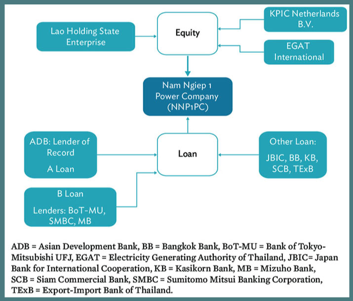
The Project is owned, managed and operated by the Nam Ngiep 1 Power Company whose shareholders were the Kansai Electric Power Company of Japan (45%), Thai-based EGAT International Company Limited (30%) and Lao Holdings State Enterprise (25%).
The total project cost was estimated at about US$ 900 to 950 million and was funded in part by Thai-based banks (Exim Bank, SCB, KBank & others) as well as by Japanese and Lao institutions.
Asian Development Bank (ADB) approved a US$ 144 million private sector loan while Japan's Bank for International Cooperation (JBIC) gave project financing of US$ 197 million.
The 290 MW Nam Ngiep 1 Hydropower Project consists of a main dam, main powerhouse, re-regulation dam and re-regulation powerhouse located along the Nam Ngiep river.
The main powerhouse is immediately downstream of the main dam and has 272 megawatt installed capacity from two Francis turbines. All energy produced from this power plant is to be sold to EGAT in Thailand via a 120 km-long 230 kV transmission line to the Nabong Substation in Vientiane Capital for re-transmission to Thailand.
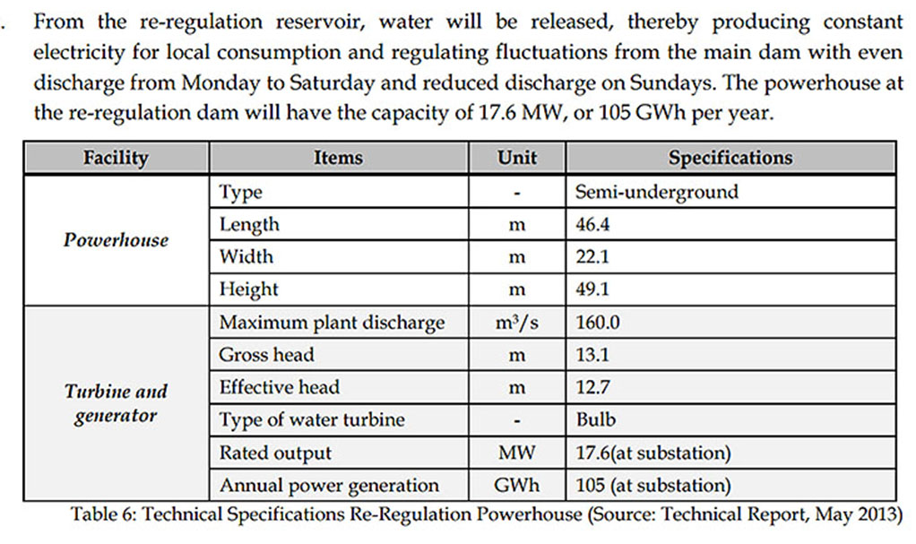
The small re-regulation dam powerhouse has 18 megawatt installed capacity and the energy produced from this power station is to be sold to Electricite du Laos (EDL) for local consumption.
The larger 272 MW power station is planned to operate on a daily basis in intermittent mode. The exact production mode will depend on the availability of water in the reservoir and demand requests by EGAT. The project is designed for daily peaking operation (such as 16 hours on and 8 hours off) for six days of the week with annual energy output of 1,515 GWh for export to Thailand.
Vietnam-based Song Da 5 Joint Stock Company was in charge of civil and main works. Right Tunneling & Obayashi Corporation of Japan were also major contractors.
Commercial Operation Date (COD) for the project was certified as September 2019.
Nam Ngiep 1 Hydropower project facilities shown in image below:
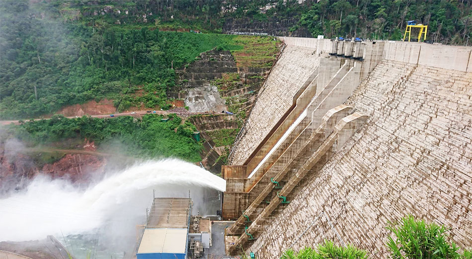
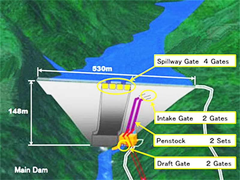
The roller compacted (RCC) dam is being constructed in a narrow valley and is equipped with a ski jump style spillway with multiple flip buckets.
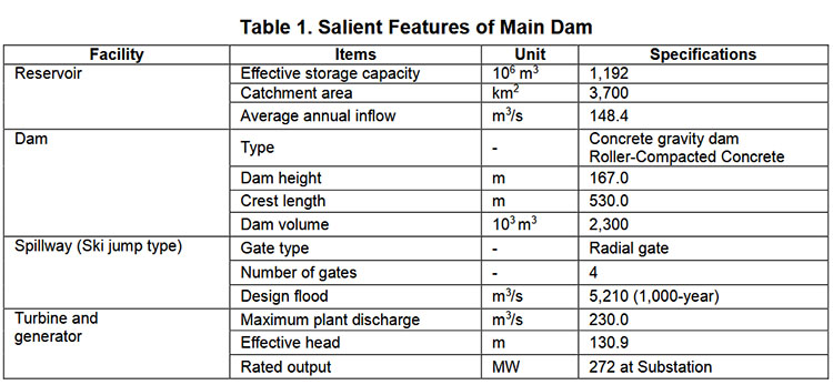
The 167 meter high Main Dam is a roller-compacted concreted gravity dam 530 meters long with a crest elevation 323.5 meters above sea level. Water from the reservoir drops 130 meters to the Main Powerhouse located on the left bank of the river when looking downstream.
Power intakes, intake gates and penstocks are installed in the main dam body. The penstocks are covered in concrete and embedded in the left side of the dam with intakes located about 43 meters below the reservoir normal operating surface level. The main dam has four radial gate spillways on top of the main dam to safely pass flood flows. The gates discharge onto a ski-jump style spillway with energy-dissipation structures.
The Main Dam creates the Nam Ngiep 1 Main Reservoir with a surface area of about 70 square kilometers at full supply level and storage capacity of 1,200 million cubic meters. The reservoir depth is about 167 meters at the Main Dam and decreases to just a few meters at the end of the reservoir about 70 km upstream. The facilities around the main dam are a river diversion tunnel, a gated spillway, an intake structure and penstock, a surface powerhouse, outlet facilities and related accessory equipment.
Nam Ngiep 1 Regulating Dam and powerhouse images below:

Regulating dam & powerhouse images below:
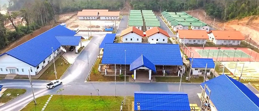
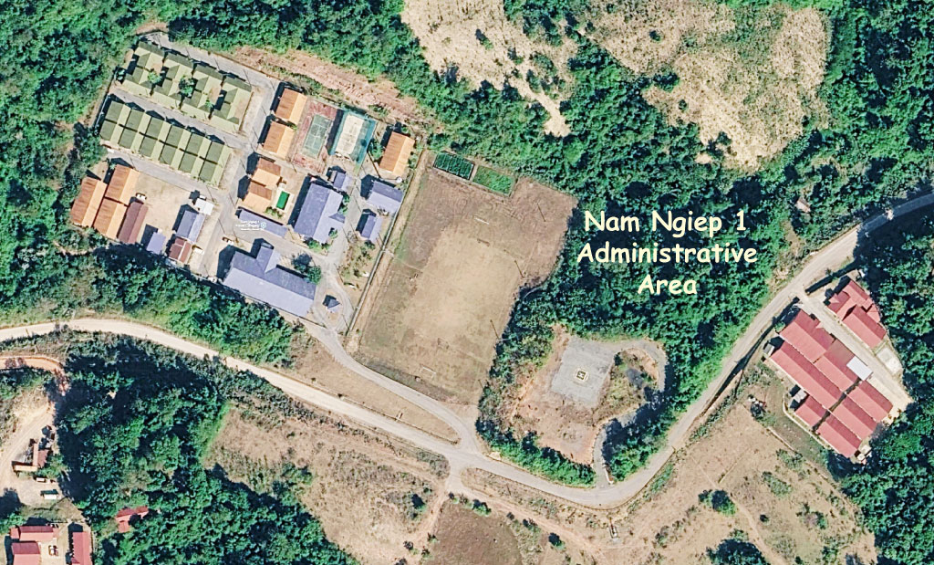
Nam Ngiep 1 administration offices seen below at coordinates - 18°38'59.6"N 103°33'11.7"E (18.649889, 103.553250).
Click to see Reservoir drone view video HERE
Electricity Generating Authority of Thailand (EGAT) signed a power purchase agreement for offtake of 269 MW (maybe 272 MW) Nam Ngiep 1 output with commercial operation date beginning January 2019. Electricity at will be transmitted through a 500 kV transmission line from Nabong Substation in Laos to Udonthani 3 substation in Thailand. The purchase agreement is for 27 years at an average price of 2.3218 baht per unit.
The project is able to operate on a peaking basis with output increased to meet higher demand at certain times.
Transmission lines of the Project are:
1) a double-circuit 230 kV line running 130 km from the Main Dam Switchyard to Nabong substation for export to Thailand and
2) a single-circuit 115 kV line running 40 km from Re-regulation Dam Switchyard to Paksan Substation for Lao domestic supply
Nam Ngiep 1 project info below:

Operating NNP1 as a peaking project results in rapid fluctuation of discharged water and requires a re-regulation dam & reservoir to release water continuously. Downstream of the re-regulating dam the river enters a large and flat floodplain and the re-regulating project required construction of an additional earth-filled saddle dam to block the river from flowing into its old channel.
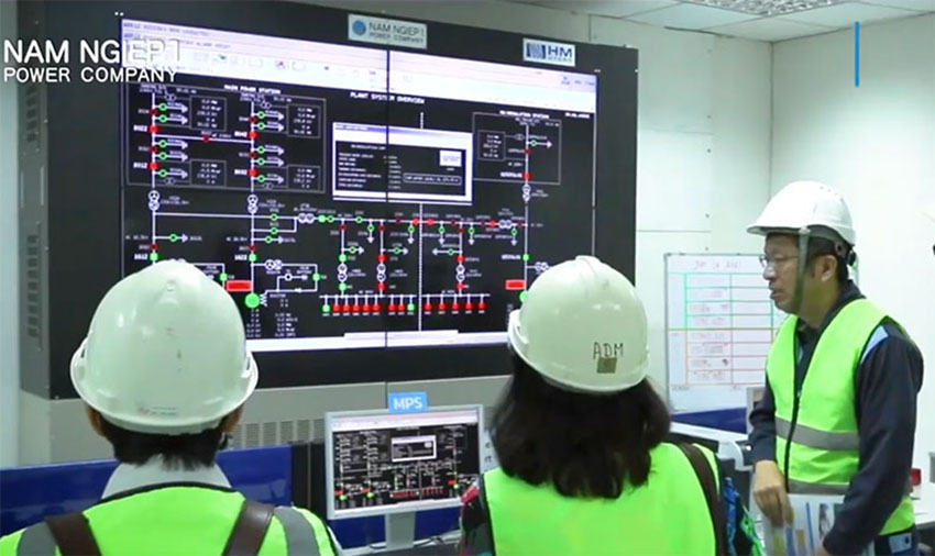
Nam Ngiep 1 control room image below:
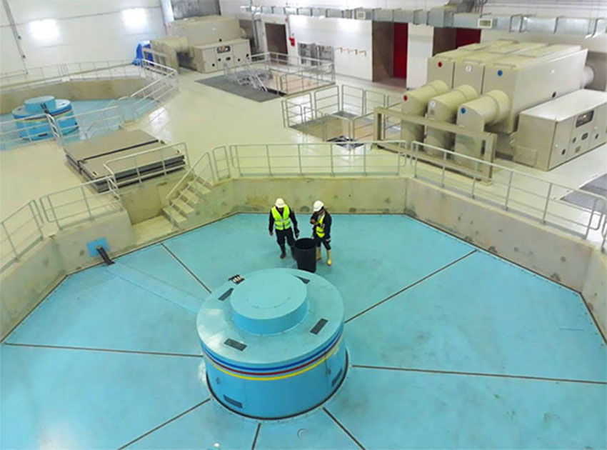
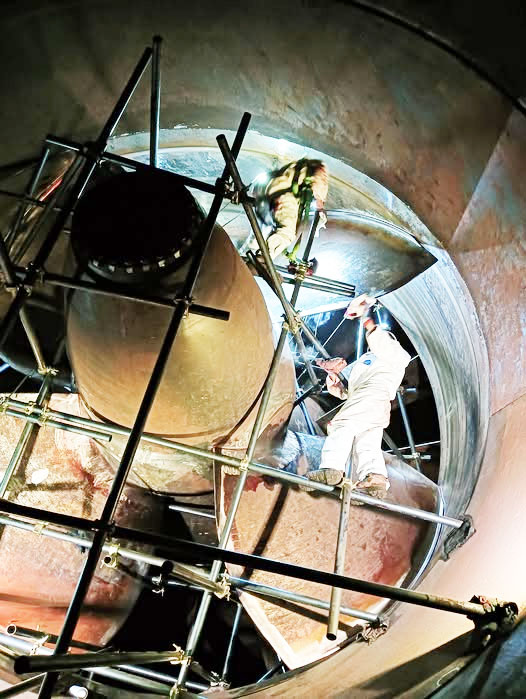
Nam Ngiep 1 powerhouse interior images below:
History of Project Development
April 2006 - Exclusive development right granted by the government of Lao PDR to Kansai Electric Power Company.
April 2013 - Establishment of Nam Ngiep 1 Power Company ("NNP1")
May 2013 - Signing of Shareholder Agreement (Acquisition of Stock in May)
On 27 August 2013 a Power Purchase Agreement with Electricity Generating Authority of Thailand (EGAT) was signed by Nam Ngiep 1 Power Company Limited.
On 27 August 2013 a 27-year Build-Operate-Transfer Concession (BOT) Agreement was signed with Ministry of Planning and Investment of Lao PDR.
Construction of the Project started in late 2014.
Project details below:

Click HERE to see our hydropower web page for the greater Nam Ngiep catchment basin area which describes the various dams, reservoirs and diversion projects in the drainage basin which are often inter-connected.
Below info and images from 2014 Nam Ngiep 1 Social Impact Study published prior to start of construction so actual construction data may not match perfectly.
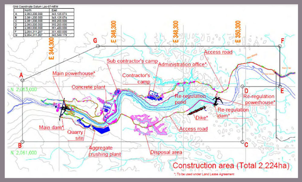
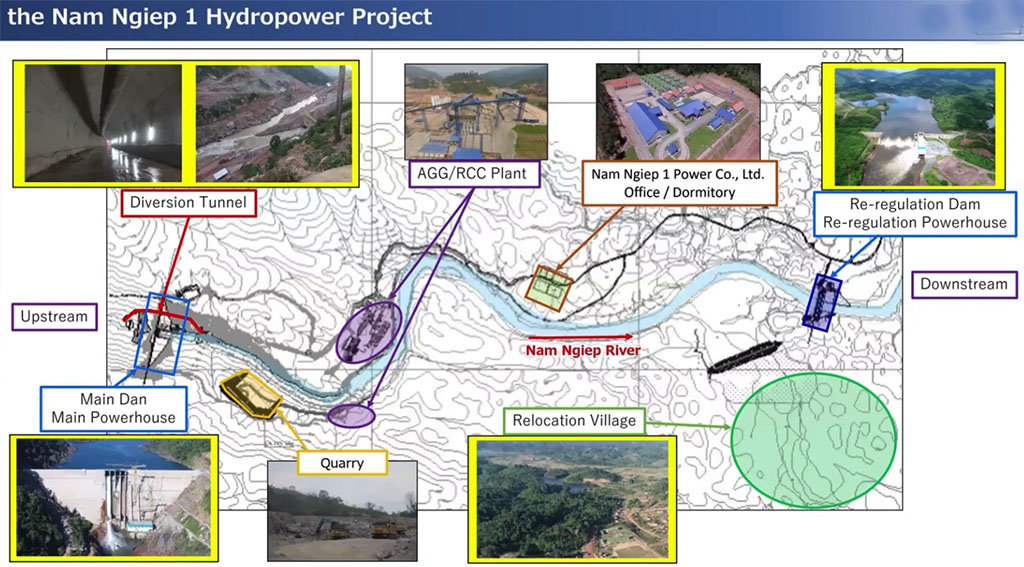
Nam Ngiep 1 construction area project layout as planned below.
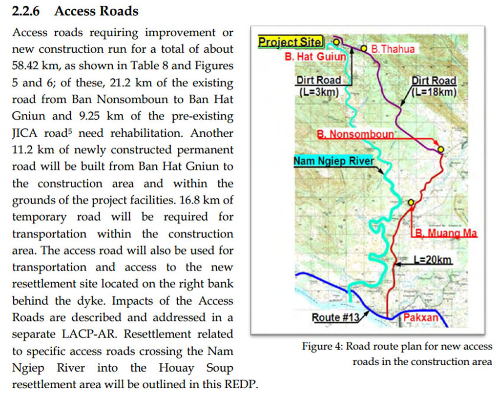
Nam Ngiep 1 project roads map below:
Dam and Reservoir. The Nam Ngiep 1 Hydropower Project (NNP1) is a 148 meter high dam located on the Nam Ngiep River close to Hat Gniun village. The NNP1 catchment is 3,700 square km at the dam site. The Project reservoir will be narrow, long and deep. The reservoir effective storage capacity is 1,192 million cubic meters at Full Supply Level of 320 meters above sea level. At this level the total surface area of the reservoir will be 66.9 square km. The Minimum Operation Level is be at 296 meters above sea level.
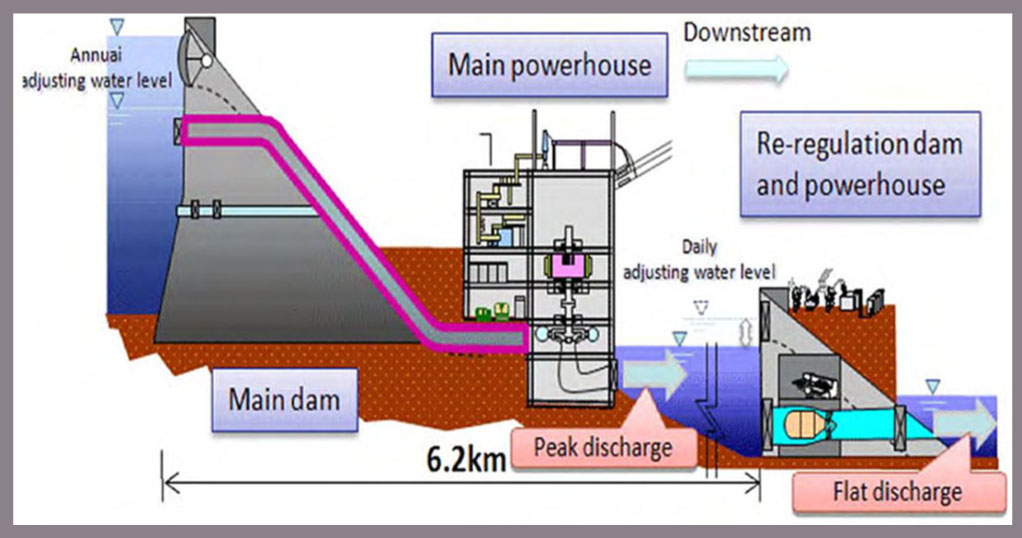
Waterways. Water will be spilled through 4 gates at the main dam where electricity will be
produced via turbines and then discharged into the re-regulation pond. To avoid
fluctuations throughout the day downstream, a re-regulation dam provides a regulated discharge. The re-regulation dam is 20.6 meters high and
creates a re-regulation pond with a surface of 1.27 square km and an effective storage capacity of
4.6 million cubic meters at Full Supply Level. Above the Minimum Operating Level, water will be used to generate electricity for local consumption.
Power Stations. A semi-underground power station is sited on the left bank of the Nam Ngiep River downstream of the dam. The power station will allow electricity production with a rated output of 272.8 MW at the substation. The average annual energy production is estimated to be 1,515 GWh. The smaller powerhouse downstream of the reregulation dam also allows electricity production with a rated output of 17.6 MW at the substation and average annual energy production of 105 GWh.
Nam Ngiep 1 project power plant image below:
Transmission Line. A 125 km-long 230 kV transmission line connects the switchyard at the power station to the Nabong substation near Vientiane. The NNP1 transmission line will run parallel with the NNP2 transmission line much of the way. At Nabong substation the transmission line will link with several other transmission lines for power transmission to recipients in Thailand.
![]()

Nam Ngiep 1 reservoir info chart below:
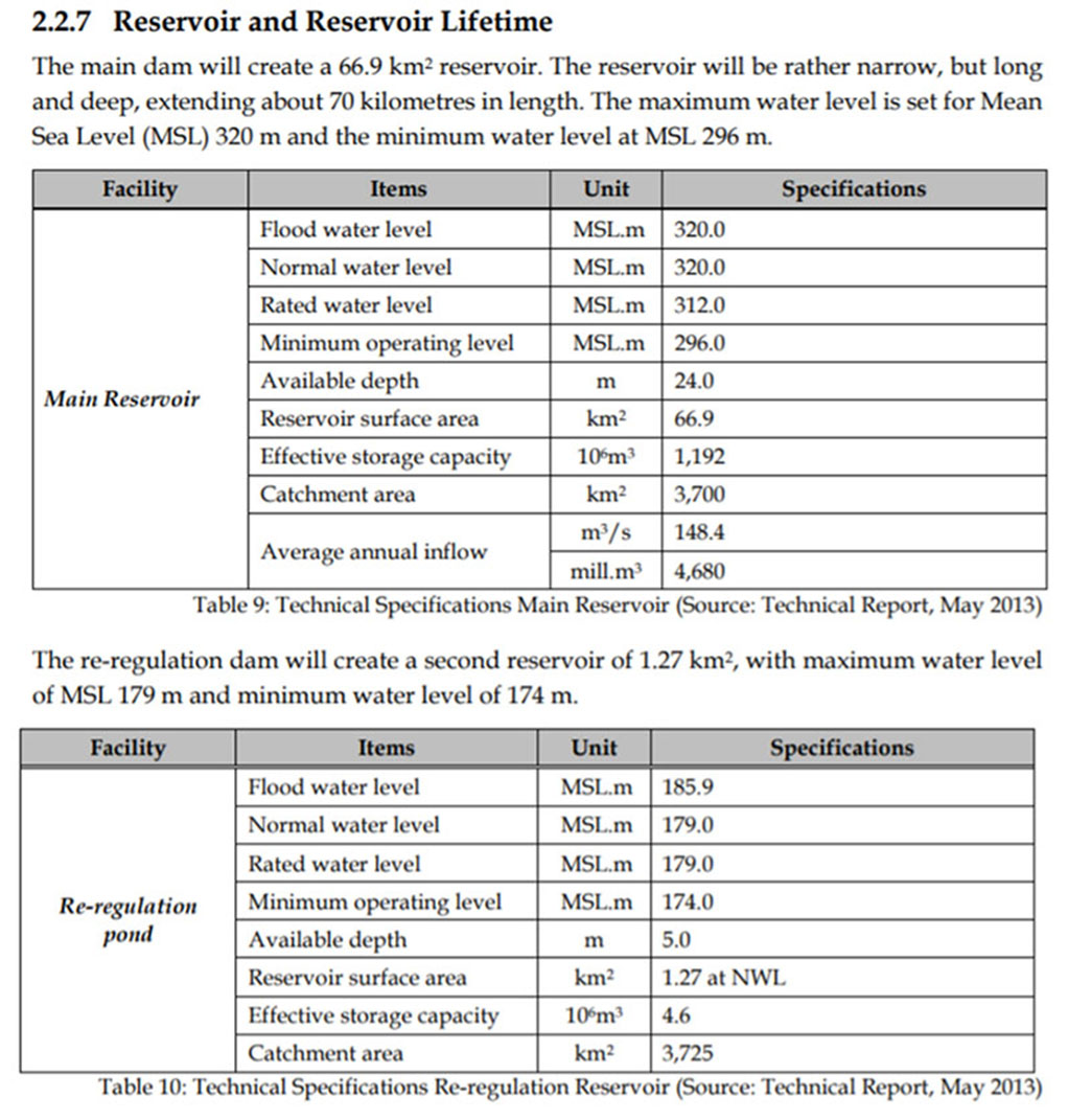
Nam Ngiep 1 project reregulation dam and pond info below:

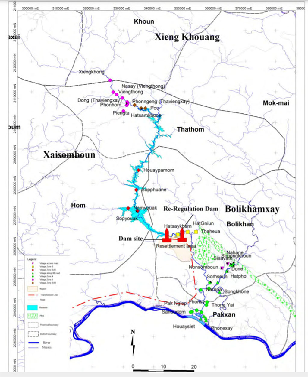
Nam Ngiep 1 project location and impact areas shown in map below.
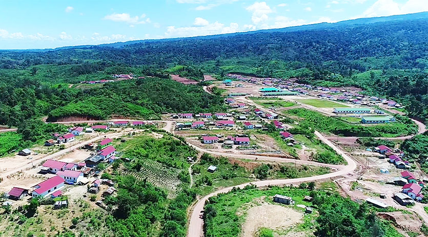
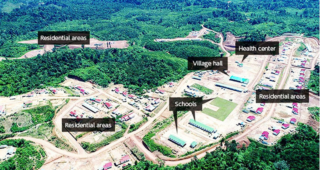
Nam Ngiep 1 Phouhomxay Resettlement Village images below.
Nam Ngiep 1 export of output to Thailand via route shown in map below. See enlarged version HERE.

Location of the project is shown on lower right side of map below:

Map of Nam Ngiep catchment area hydropower project locations is below:
