Nam Che 1 Dam Hydropower Info - Namche 1 Dam - by Hobo Maps- Go to Hydropower Projects Page - - - HOME
Nam Che 1 Hydropower project is located near Namlong village and Samgorthong village, Thathom district, Xaisomboun Province in Lao PDR.
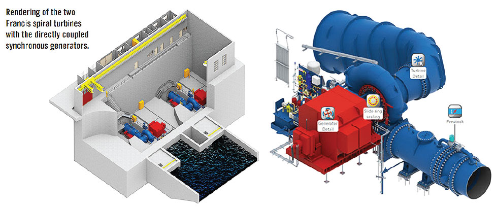
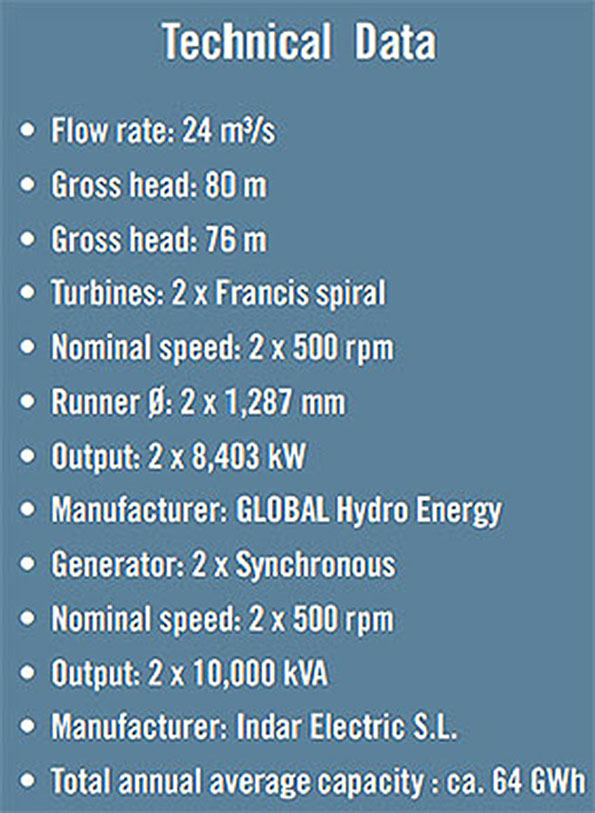
The project has a small dam and reservoir. The powerhouse contains two 8.4 MW Francis turbine-generator units for 16.8 MW total installed capacity. Annual output is estimated at 68.4 GWh.
The project developer, Nam Che 1 Hydropower Company Limited, is a joint venture between Thai-based B. Grimm Power Co. Ltd. (a unit of B. Grimm Group) and Daosavanh Co. Ltd. (an engineering company in Laos).
Nam Che is pronounced like "Nam Chay".
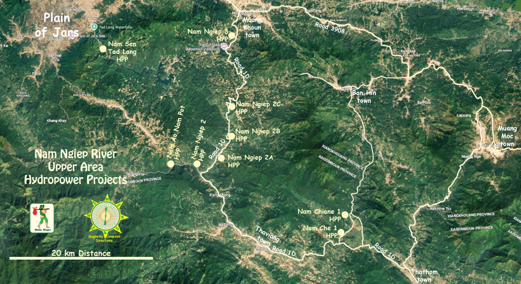
Nam Che 1 HPP location is seen at the lower section of Nam Ngiep upper area map below:

Power plant below located at coordinates 19°02'57.1"N 103°30'15.2"E (19.049196, 103.504230)


Dam structure below located at coordinates 19°03'17.1"N 103°30'48.6"E (19.054753, 103.513500)

The Nam Che 1 Hydropower plant project has been supplying electricity to Electricte du Laos (EDL) since June 1, 2019 (Commercial Operating Date) under a 25-year power purchase agreement for domestic consumption.
The run-of-river hydro project is on the Nam Che River in Xaisomboun province and was estimated to cost US$ 49 million.
Austria-based GLOBAL Hydro Energy was a major contractor for the project by providing a comprehensive turnkey package of electromechanical and control infrastructure.
Nam Che 1 Dam images below - we can see the Nam Chiane 1 penstock and power plant in the upper background not so far away and north of the Nam Che 1 dam and reservoir seen in the lower area of these images:
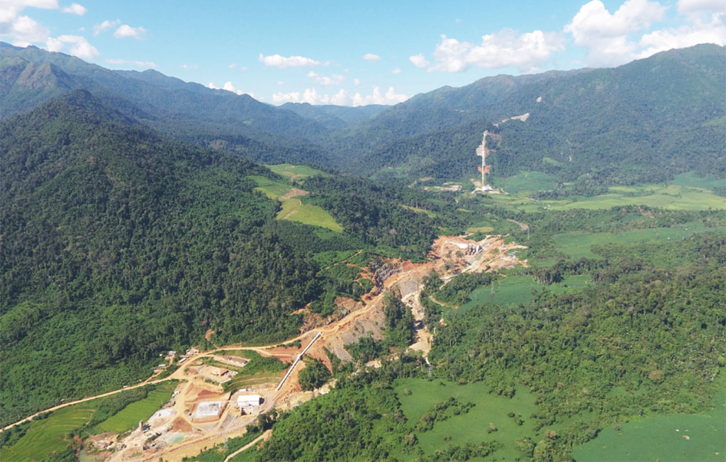


The dam structure is 23 meters high and 50 meters across with an overflow edge and two weir gates.
Sediment in the water is settled-out in a stilling chamber ahead of the high-pressure channel when flow velocity is reduced, possibly negating the need to install a desander.
Most of the 300-meter head water-descent stage is encased in an underground concrete conduit. The water then flows into an above-ground steel channel just before the power plant.
The power generated is conducted from the generator to medium-voltage switchgear, then to transformers and finally to Thavieng Substation via a 15 km-long transmission line.
Nam Che 1 & Nam Chiane Hydropower Project sites image below.

Nam Che 1 administration building below:

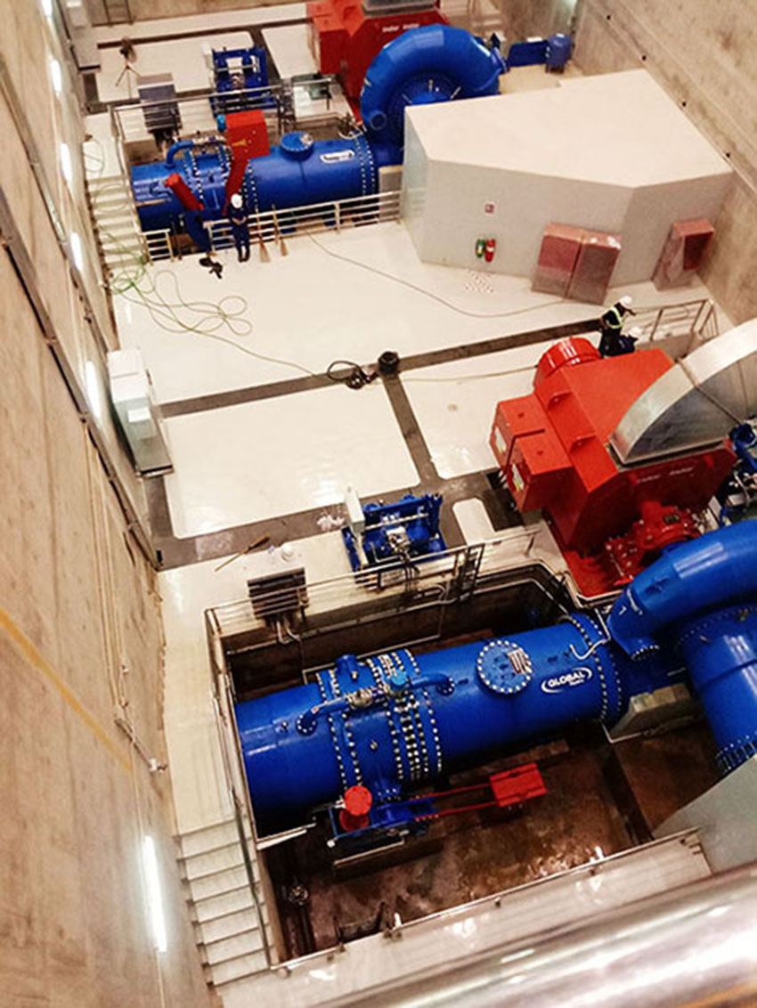
Images of Nam Che 1 turbine/generator sets below:
Nam Che 1 plant building below:

Nam Che 1 switch yard image below:

Nam Che 1 project images below:


Nam Che 1 hydropower project shown at right side of map below:

Satellite image map below for Nam Ngiep River Basin hydropower projects:

Nam Che 1 shown in watershed map below:

click HERE for more info about entire Nam Ngiep watershed catchment area