
Houay Por Dam Hydropower Info - by Hobo Maps - Go to Hydropower Projects Page - - - Home
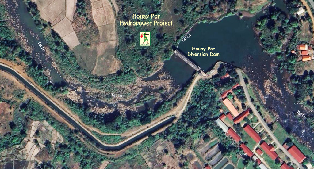
Houay Por Hydropower project is located along the Houay Por and Xeset rivers in Lao Ngam District, Saravan Province of southern Lao PDR. The project is downriver and not far north of the Xeset 1, 2 and 3 hydropower projects on the XeSet (river).
The project is located near the villages of Houa Khua Set, San Thong and Nakalon about 30 km from Saravan (Salavan) City and about 7 km from National Road 20.
Houay Por Hydropower project is also called Houay Poh (Po) and sometimes known as Xeset Downstream HPP.
Houay Por HPP location and layout images below:
Installed capacity is 15 MW from 4 sets of Horizontal Francis Turbine/Generator sets - 2 sets at 5 MW each and 2 sets at 2.5 MW each
Annual capacity output is estimated at 60 GWh.
Project construction began in February 2015 by Hydrochina Kunming Engineering Corporation CO.,LTD., was completed in July 2017 and has been in operation since 2018. The project operates under a 30 year concession by government of Lao PDR.
Electricity du Laos (EDL) offtakes the output for domestic consumption within Laos.

The project has a diversion dam that diverts water flow from the Xeset (or Tat Lo) river along 6 km of open channels into the Houay Por Hydropower project to take advantage of a water head of 64 meters.
Houay Por diversion dam images below located at coordinates - 15°32'37.8"N 106°15'39.0"E (15.543828, 106.260821) near Ban Saenvang and National Road 20.

The project owner is Huai Por Power Co., Ltd. (also spelled Houay Por Power Co. Ltd.)
Huafei (Huefai) Energy Investment (Chinese Co.) may be a major shareholder (not confirmed)
Construction began on November 13, 2014
Khounkham Group was involved in the construction.
Project cost: $ 24.3 million US.
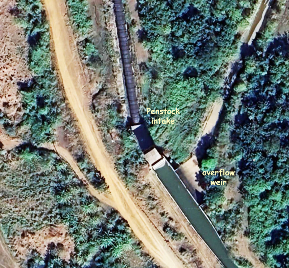
A head pond along the open diversion channel is used for temporary water storage to regulate a constant flow into the 1 km-long penstock just above the powerhouse. Penstock pipe has a length of 990 meters.
Houay Por head pond images below located at coordinates - 15°33'17.0"N 106°14'04.5"E (15.554713, 106.234590)


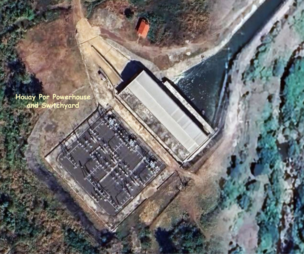
A two km-long open tailrace channel carries discharged water from the powerhouse back into the XeSet river.
The project includes a concrete gate dam, trapezoid open channel, concrete core earth rock-fill auxiliary saddle dam, open fore bay, penstock, ground workshop, power house and tailrace.
Penstock intake & overflow weir images below:

Reservoir surface area is 35,000 square meters with maximum surface level at 323.9 meters above sea level and normal Full Supply Level is 322.5 meters above sea level. The main dam is 12 meters high and 98 meters long with a reservoir capacity of 76,000 cubic meters.
The secondary dam is 7 meters high and 217 meters long with a reservoir capacity of 135,000 cubic meters. Full Supply Level is at 320 meters above sea level.
The working discharge flow rate for power generation is 29 cubic meters per second.
Houay Por powerhouse and switchyard images below located at coordinates - 15°34'31.3"N 106°13'24.5"E (15.575363, 106.223475)

Powerhouse interior images below.


Houay Por HPP images below:


Xeset River Hydropower map below shows Xeset 1, 2 & 3 hydropower projects in the lower area plus Houay Por project at the top - all on the XeSet (river):
Houay Por & Xeset 1, 2 & 3 dams layout map below:
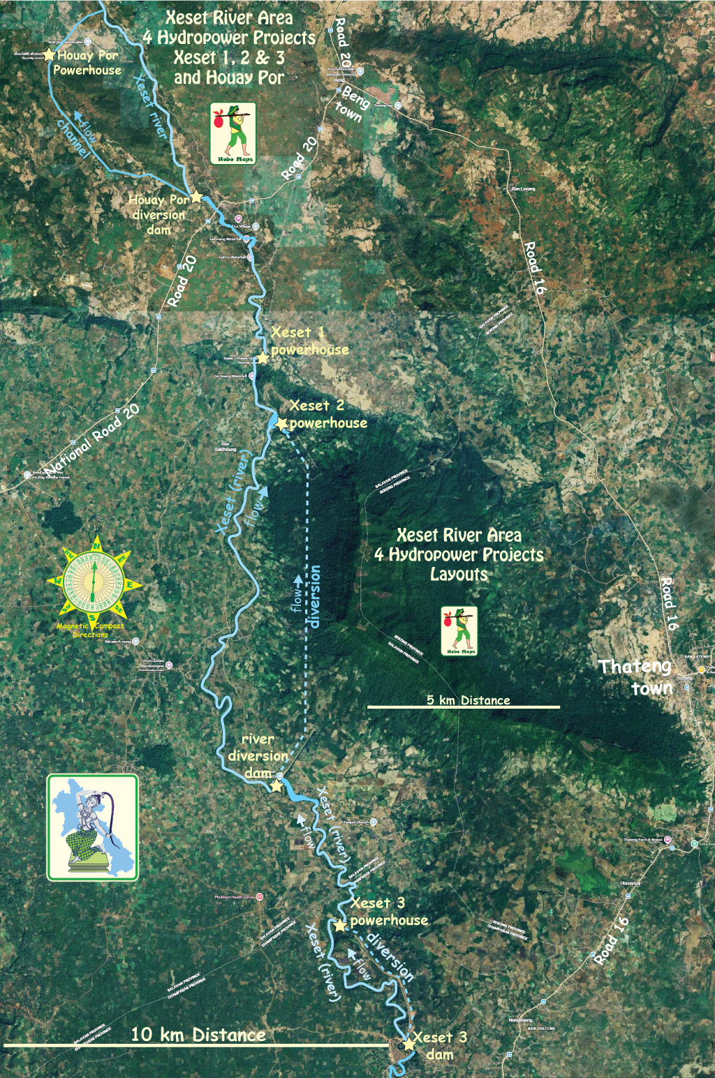
Click to see larger scale version of this map below - Houay Por & Xeset Dams Map

Houay Por hydropower project located at mid section of map below:
